Curriculum
🎓 Teaching in the Digital Age 2023: Proven strategies for Interdisciplinary STEAM STEM Education, Hands-on activities, Problem-based and Collaborative Learning, AI, Social Skills, Online Safety and Inclusion
🎓 Intro Teaching and STEM Education in the Digital Age
0/15🎓 DigiCompEdu and Active Methodologies in Education
0/7🌐 Going Online Safely - Digital Literacy and Citizenship
0/12🤝 Life Hacks and Social Skills
0/20🔬 STEM Education in the Classroom and Emerging Technologies
0/12🔬 STEM Activities - Resources and using Game to Learn
0/21-
🎓🎧💡 Fun STEM Activities for Students of All Ages
-
🔲🎧🎨🍎⚙️🥼💡 Exploring Simple Machines with Roblox: A Hands-On Approach to STEM Learning
-
🍎🔌⚡💡🥽 LAB: Static Electricity
-
🟢🌌🛸💡🌍 Explore The Earth, ISS and the Solar System with Google Maps
-
🌌🛸🎧💡👉 Explore The Solar System Interactive Tour and How a 360° video works
-
🚀👩🔬🎓💡 NASA STEM Engagement Resources and Rocketry activities
-
🚀🎧💡🔗 Ideas and safe Rocketry STEM activities
-
🆕🟢🎮⛏️🎓💡🎧🛸🧪 Using Minecraft to learn STEM/STEAM, Chemistry and Space Exploration
-
🎓👽🔬🎧💡 KSP for STEM Education as a tool for learning and experimentation, designing and testing
-
🎓🧮🥽💡🥼🔬🎨🧰🎧 Desmos Classroom a powerful tool for math lessons online.
-
🌌 Astronomy Course 🎨 STEAM 🔬 STEM Education series
-
🟢🚀🎓💡🔑🔬🥼🎨🎧🎬🅰 MOVIES: Advice for Aspiring Rocket Scientists and a Rocket Engineer Reviews of “October Sky”
-
👽🎓🔑💡🥼🔬🎨🧰🧪 Intro Chemistry in 🚀 Rocketry with KSP
-
🆕🦾👽🛸🎓💡🥼🔬🎨🧰🎧 Robotics: Rover and Robot in Space with KSP Kerbal Space Program
-
🟢🎮👽🎓💡🥼🔬🎨🧰 Using KSP to Learn the STEM (science, technology, engineering, and math)
-
👽🎓💡🥼🔬🎨🧰🎧 First steps and Science with KSP
-
👽🎓💡🥼🔬🎨🧰🎧 Career and Science mode and tutorial
-
🆕🛸🎓💡🥼🔬🎨🧰🎧 Elon Musk’s SpaceX Falcon Heavy
-
👽🎓💡🥼🔬🎨🧰🔑 Solar system scale on KSP
-
🎓🤦♂️🎧💡🔗🔑🔬🎨🧰 How Teach Kids to love Science / STEAM, real-world challenges
-
🎓🤦♂️🎧🧮💡 Building a Strong Foundation in Mathematical Skills
🎨 STEAM Education 🛠️ Tinkering - Making and 💻 Coding
0/11🤖 AI 📏Personalized Learning 🧘♀️ Well-being
0/22🏛 Extracurricular Initiatives and Partnering with Local Organizations and School Network
0/3🟢🌌🛸💡🌍 Explore The Earth, ISS and the Solar System with Google Maps
Google Maps is a powerful and versatile tool that can be used to explore the Earth, the International Space Station (ISS), and the solar system. With Google Maps, you can view detailed maps of the Earth’s surface, including satellite images, terrain, and street maps. You can also use Google Maps to view the ISS in real-time and to explore the planets and moons of the solar system.
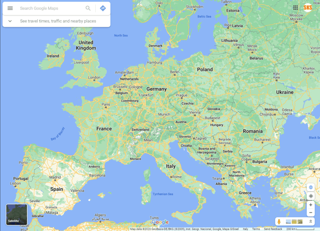
To use Google Maps to explore the Earth, you can simply go to the Google Maps website and enter a location or address in the search bar. This will bring up a map of the area, showing satellite images, terrain, and street maps. You can use the tools and controls on the map to zoom in, zoom out, and pan around to view different parts of the map. You can also use the search bar to find specific places, such as landmarks, buildings, and businesses.
To view the ISS on Google Maps, you can go to the “Live Feed” section of the website and select the “ISS Tracker” option. This will show you a map of the Earth, with a dot indicating the current location of the ISS. You can use the controls on the map to zoom in and out and to pan around to see different parts of the Earth. You can also use the timeline at the bottom of the map to view the ISS’s past and future orbits.
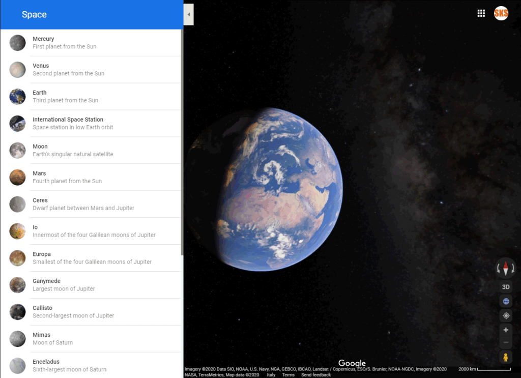
To explore the planets and moons of the solar system on Google Maps, you can go to the “Solar System” section of the website. This will show you a 3D model of the solar system, with the Sun at the centre and the planets and moons orbiting around it. You can use the controls on the model to zoom in, zoom out, and pan around to view the different planets and moons. You can also click on the planets and moons to view more detailed information about them, including their size, mass, and distance from the Sun.
In conclusion, Google Maps is a powerful and versatile tool that can be used to explore the Earth, the ISS, and the solar system. With Google Maps, you can view detailed maps of the Earth’s surface, view the ISS in real time, and explore the planets and moons of the solar system. To use Google Maps, you can simply go to the website and enter a location or address in the search bar, or use the tools and controls on the map to explore different parts of the Earth, the ISS, and the solar system.
Google Maps is a web mapping service developed by Google. It offers satellite imagery, aerial photography, street maps, 360° interactive panoramic views of streets (Street View), real-time traffic conditions, and route planning for travelling by foot, car, bicycle, and air (in beta), or public transportation. Most people use it to find an address or to plan a route, but there is much more if you know how to use it. Google Maps is no longer just for getting directions here on Earth. You can now explore numerous planets, moons, and the International Space Station using a new Google Maps feature.
💡 Explore The Earth
- Open Google Maps
- Find your house and see it on satellite view
- Find the fastest route to your best friend’s house and check the traffic condition
- Find the best direction for a theme/fun park in your area
- Visit some famous cities worldwide like Rome, Paris or London
💡 From Earth to ISS and Space exploration
- Open Google Maps and set in Satellite view by clicking on the bottom left selector
- Zoom out till you see the full Earth in space and the left Space sidebar will appear
- Start your tour from Mercury by clicking on the left sidebar and zooming in to see the surface with the naming of the main area
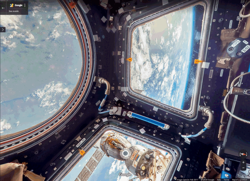
- Visit the ISS Internation Space Station, from the incredible Italian Cupola that provides spectacular views of Earth and celestial objects.
- Go to the Moon and try to find the landing zone of the Appolo mission
- Explore Mars and try to find the “Face” and one of the many rovers’ area
- Explore Pluto and the other moons


